
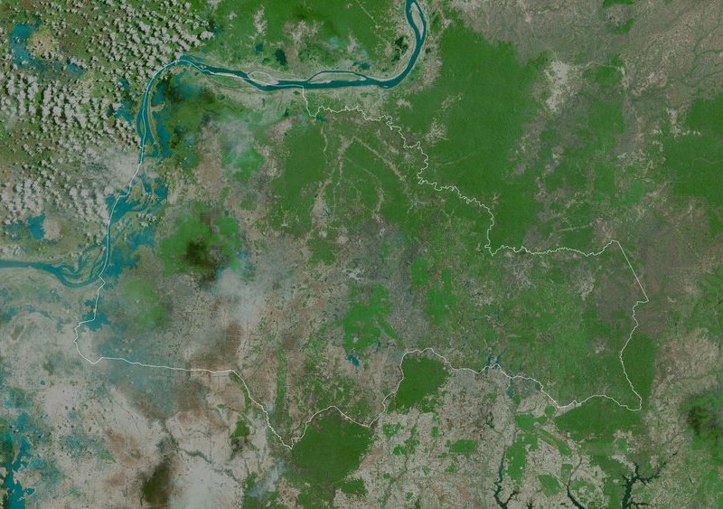
A satellite image of the Tbong Khmumre region, Cambodia.
Photo: © Yarr65/Shutterstock
 Read this article in French
- Share this article
- Subscribe to our newsletter
ICRISAT – Geospatial Mapping for Sustainable Agriculture in South Asia
With only six annual harvests remaining before the 2030 Sustainable Development Goals (SDG) deadline, the need to sustainably intensify agricultural production has never been more urgent. Drylands, in particular, present a significant opportunity to enhance agricultural productivity and contribute to global food security.
“Dryland cropping systems are complex, shaped by biophysical, social, and economic factors. The use of geospatial products and satellite data for mapping these systems can be invaluable. These tools provide critical insights for decision-making, unlocking opportunities for increased production, and enhancing farmers' incomes in these challenging environments,” says Dr Stanford Blade, Deputy Director General-Research at ICRISAT in Hyderabad, India.
The study covering an area of 477 million hectares spanning across India, Pakistan, Nepal, Bhutan, Bangladesh and Sri Lanka, identified and mapped 27 major cropping systems.
Highlighting the uniqueness of this research, Dr ML Jat, Global Research Program Director, Resilient Farm and Food Systems, states: “Predominantly, studies use spatial data to map single or major crops such as rice, wheat and sugarcane or to monitor crop intensity, natural vegetation and more. This study is a trailblazer in understanding the entire cropping system, i.e. crops grown in a sequence over the entire year.”
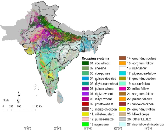
Spatial Distribution of Cropping Systems in South Asia. Graphic: © ICRISAT
This time series data provides a fresh perspective on rethinking and redesigning cropping systems, addressing food security and climate resilience challenges in the near future.
According to the study’s lead author Dr Muralikrishna Gumma, the data serves as a foundational layer and could be used in various ways to understand and improve agricultural performance. “When combined with climate and soil data, it can aid in planning for resource optimisation and enhancing agricultural productivity,” Gumma notes.
Data sets offer detailed information to governments to optimise resource allocation
On a global scale, these geospatial maps provide essential data that can guide climate change mitigation efforts. At national level, these data sets offer a detailed understanding of regional cropping patterns, enabling governments to optimise resource allocation.
Geospatial mapping can inform policies that ensure the efficient distribution of resources like water, fertiliser and seeds, based on the specific needs of different cropping systems. Additionally, these maps can be integrated into disaster management strategies, helping to identify areas vulnerable to agricultural stress, such as droughts or floods, and allowing for more targeted and effective responses.
(ICRISAT/wi)
Reference:
Murali Krishna Gumma et al.: Spatial Distribution of Cropping Systems in South Asia Using Time-Series Satellite Data Enriched with Ground Data; MDPI Remote Sensing Open Access Journal, July 2024, 16 (15), 2733; https://doi.org/10.3390/rs16152733
News Comments
Current Print Issue
Coming Events
10-12 October, Pinggu-Beijing, People's Republic of China
WAFI 2024 - World AgriFood Innovation Conference
21 October - 1 November, Cali, Columbia
United Nations Biodiversity Conference COP 16
23-24 October, Nairobi, Kenya
One Planet - Sustainable Bioeconomy Solutions for Global Challenges
Information: Website
Add a comment
Be the First to Comment